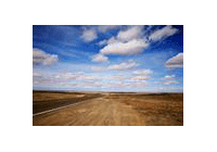
Szechuan Basin is an intact basin surrounded
by mountains, with an average altitude of about 300 to 600 m. It is the fourth largest
basin in China. It has the most typical terrain, the southern-most position, and
the lowest altitude among Chinese big basins. With an area of about 200,000 square
km, it is located in the east of Szechuan province, and at the upper reaches of
Yangtze River.
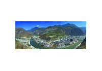
The climate of the basin is warm in winter and hot in summer, with small temperature
defferences and plenty of rain. In winter, it is mostly cloudy and foggy. There
is a 200 km long and 40 - 70 km wide plain in the northwest of the basin, which
is the famous Chengdu Plain where the world-famous Dujiang Weirs is also built there
to irrigate the fertile land. Since ancient times, Chengdu Plain has had well-developed
agriculture and abundant products, enjoying the reputation as "Land of Abundance".
Do you know?
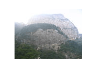
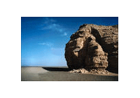
In Szechuan Basin, the hills are undulating. From the top to the foot of the hills
are the purplish red arenaceous shale and the mud formed by the weathering shale.
If you take a broad view of the basin, everywhere is purplish red, so people call
it the "purple basin".
Previous Next